


South Mastick Picnic Area
Directions below map.
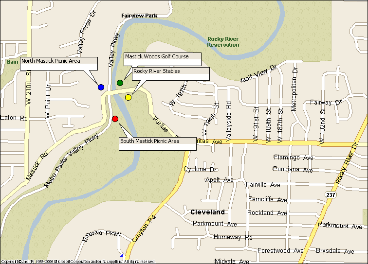
The South Mastick picnic areas is just south of the intersection of Mastick Road (or Puritas Road) and Valley Parkway. This is about 3 miles north of the Rocky River Nature Center.
Directions
Via I-480: Take I-480 to the Grayton Road/ Airport exit. Follow Grayton Road north until it dead-ends at Puritas Road. Turn left and go down the hill. At Valley Parkway, turn left. Watch for South Mastick sign on the left. Meet in parking area near the sign.
Via Valley Parkway:
From Lakewood, follow Valley Parkway South. Go past Big Met and Mastick Woods Golf Courses. After passing Mastick Road, watch for South Mastick picnic area sign on the left. Meet in parking area near the sign.
From North Olmsted or Berea, take Valley Parkway north. Pass the Rocky River Nature Center, and go under the huge bridges for Brook Park Road and I-480. Follow the winding road. South Mastick Picnic area is on the right, opposite the Spring Wild Flower trail. Meet in parking area near the sign.