


Vegetation Survey 2007
| Forms for Surveyors: | Photos courtesy of Terri Martincic |
| 2007 Vegetation Survey Results | |
| Welcome to the Western Cuyahoga Audubon
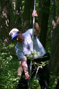
Society's (WCAS) Rocky River Important Bird Area 2007 Vegetation Survey. For two years WCAS observers have been surveying birds from 60 points in the Rocky River watershed. Now we are surveying the vegetation at these points. The survey will help us understand the forest habitat in the Cleveland Metroparks Rocky River, Mill Stream Run and Hinckley Reservations and habitat’s impact on bird populations. See the WCAS website for maps, instructions, survey sheets. Please review the instructions ahead of time, there is a lot of information to cover. It will become clear during the field training. http://www.wcasohio.org/rocky_river_iba.htm Join us for field training on July 15, 2007 at 2:00 at the Chalet in the Mill Stream Run Reservation between Route 42 (aka Pearl Rd) and Route 82 (aka Royalton Rd). We will review procedures, and distance estimation in meters, plants including tree, shrub, and herbaceous identification. And we’ll actually complete a point. Additional equipment will be available including Densionmeters and Infrared Range Finders used to estimate foliage cover and canopy height. If your points are complete you could return your equipment at the field training, and if your willing pick up a Densionmeter to measure canopy cover and the Range Finder to measure canopy height. Groups of four are ideal, feel free to invite friends to attend the training or out in the field with you. Let us know who helps out and we'll invite them to our IBA celebration potluck in the fall to learn about the results of the bird and vegetation surveys. New people are getting involved, including some plant experts. Let me know if you can work with an additional person. We hope to have most points done by August 15, and all points done by August 31. This is a one-year vegetation study; it could be repeated in 5 years to monitor the impact of the Emerald Ash Borer. Completed survey forms will go to Diane Sigler. Why do a Vegetation survey of the Rocky River Important Bird Area? Our vegetation survey will look the habitat of each point covered by the bird observes and records. Many bird species have very specific habitat needs. Each of our 60 points will have four subplots each measuring 5 meter radius. The Vegetation survey will look at the following: Trees and shrubs growing over 1.4 meters, or breast height will be identified (genus or species), measured and counted. Woody seedlings and shrubs will be counted if they are above 1.4 meter, or ankle height. We’ll identify only plants present in more than 20% of the circle. The height of the highest part of the canopy will be estimated in meters, we hope to get equipment to measure the actual height. Vegetation profile will be determined with the telescoping pole pictured above. Hits will be recorded for multiple heights from 0-.5 meters up to 4-5 meters. The largest tree in the photo above is an Ash, our study is occurring just before the Emerald Ash Borer comes to the Cleveland area. Many Ash will be lost, our study could be repeated in 5 years to show the impact on birds and habitat. Using the densionmeter pictured below we will measure the canopy leaf cover from the center subplot. Just imagine each square is split into four quadrants giving us almost 100 squares. How many of those 100 don’t have significant vegetation. If 10 squares don’t show vegetation, we have 90% cover. We will estimate the slope and the aspect, the direction of the slope. Distance to edge, large edges are canopy openings over 30 m wide, small edges are canopy openings between 10 and 30 meters. This is a big project and we need your help, contact Terri Martincic at 440-759-8220, or email naturenut@wowway.com to get involved.
|
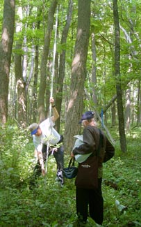 Measuring canopy height |
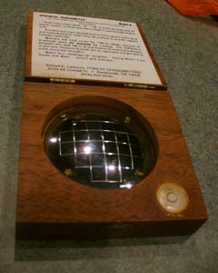 Densionmeter |
|
 Dan our instructor |
|
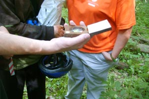 Training with Densionmeter |
|
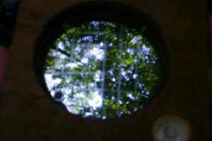 View of Canopy in Densionmeter |
|
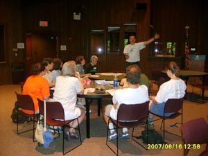 Inside training |
|
.jpg) Nidia counting vegetation. She's counting live woody stems that are at least ankle height, but less than breast height. In this case it was all non-native, invasive Honeysuckle. |